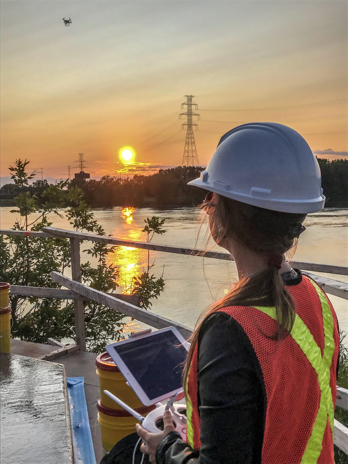
Drones are used in many sectors of activity, and are constantly improving in terms of performance, manoeuvrability and affordability, offering an ever-broadening range of applications and enhancing the efficiency of engineers and technicians. Completing projects more quickly results in cost savings. Far from replacing human labour, drones facilitate it and make it safer.
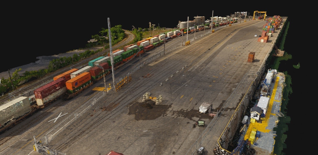
Innovation in drone technology is mainly based on the development of on-board tools, i.e. the equipment that is mounted on them. For example, thermal imaging cameras allow detection of failures in high-voltage power lines. Another example is LIDAR, a ranging system that uses reflected laser light. In addition, high-dynamic-range imaging sensors, combined with automated image capture, make it possible to obtain image sets with a high overlap percentage, which can then be used to create a 3D model using photogrammetry.
Improvements have also been made to the drones themselves with a view to improving safety. Most of the circuits (motor, GPS, etc.) on the latest models are triple-redundant, so that the craft can remain operational in the event of a technical failure.
Applications in a variety of areas
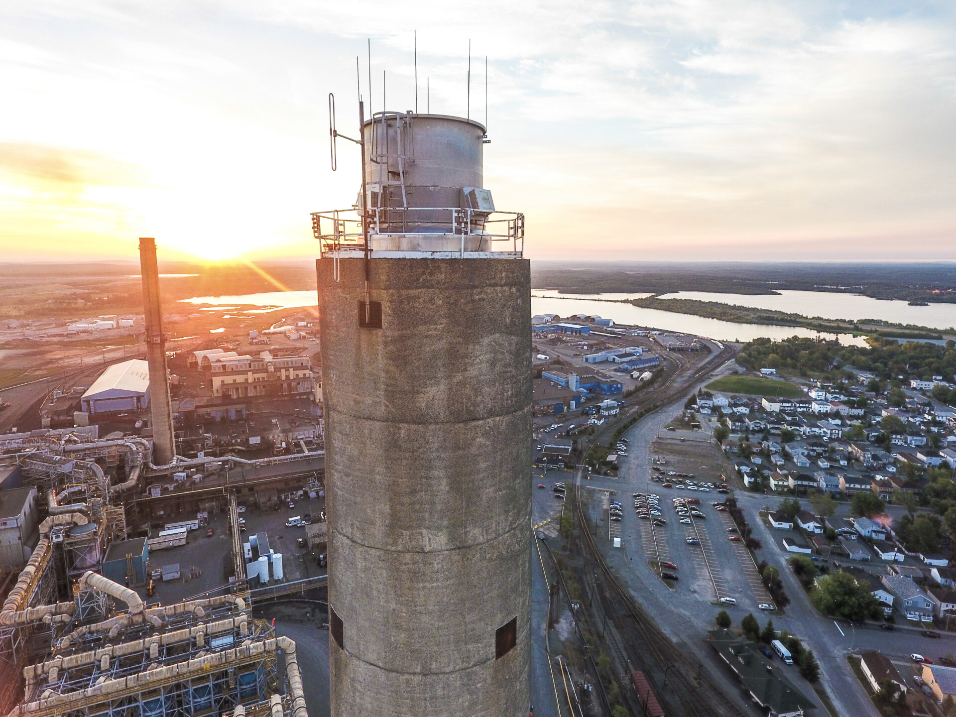
Drones are used in such diverse sectors as agriculture and environmental protection, where they make it possible to identify flood-risk areas or monitor sensitive zones, such as shorelines. In engineering, drones facilitate the inspection of infrastructure assets, such as bridges or smokestacks, in order to detect cracks. They are also used in urban planning and transportation, making it possible to generate 3D digital terrain models. They can be used to monitor locations that are dangerous or difficult to access (e.g. a reactor chimney), without having to send in workers, which considerably reduces the number of risky tasks. Of course, if a problem is detected at the inspected location, a technician will carry out an intervention, but will know exactly where to go and what conditions they will have to deal with.
CIMA+ recently carried out a complete mapping of target sectors for the Port of Montreal. The resulting data made it possible to reorganize transportation flows and make more efficient use of the network. Mapping of the Port of Montreal railway lines required thirteen hours of work. Without drones, technicians would have been forced to use traditional surveying methods, which would have taken about a week, and generated less information and less accurate results.
An ever more promising future
CIMA+ is currently working to create a Centre for Drone Excellence, where pilot training will be provided for engineers and technicians who are already working at the firm, and who could benefit from drone-mounted tools in their areas of activity. It is safe to say that CIMA+, and the industry in general, will have to train and recruit more and more pilots to meet the demand.
The scope of drone applications is bound to evolve. For example, CIMA+ is currently working on an on-board sensor project to facilitate the exploration of enclosed or confined spaces. It is a good bet that the use of drones for professional purposes will continue to expand in numerous sectors. The new legislation governing drones that was recently adopted in Ottawa and implemented by Transport Canada in January 2019 reflects this reality. By regulating the use of drones and introducing licensing for pilots, it contributes to enriching and facilitating the professional use of these tools while ensuring safer use among private individuals, indirectly making drones more acceptable to the rest of the aeronautical sector.