At CIMA+, field surveys are crucial to many of our projects. Indeed, numerous mandates require one or several photo surveys and drawings with georeferenced coordinates. Without question, the technology is precise and highly effective.
But then, some projects require a more detailed approach. For example, when a road, bridge, or similar structure is mostly obstacle-free without many surprises, our standard capture process provides all relevant data. On the other hand, when a space contains significant obstacles and environmental variables (common in urban settings), it becomes necessary to scale up photogrammetry processes accordingly.
Our road expert Jérémie Lacasse has been hard at work implementing a ground survey method that accommodates increasingly complex projects. And thanks to his tireless efforts, we're implementing a winning approach that leverages accessible, cost-effective tech. In fact, we've already launched and completed several pilot projects using the technology to great success!
More on all these exciting undertakings in a minute—first, let's look at how this technology works and what the new service aims to do for our internal operations and clients.
Accessible tools that make the difference
Indeed, the technology we're using is probably already known to the general public. Real estate companies, for instance, often use it for virtual tours. And then, of course, there's Google Maps. But although Georeferenced 3D models aren't exactly new, the technology is nevertheless improving rapidly, and practical methodologies are being developed. Here's how we're implementing it.
With the proposed approach, Georeferenced 3D models are produced from photos and videos captured using Bentley's ContextCapture software. What's great is that the necessary hardware for the capture process is readily available and affordable. For instance, we employ common devices such as iPhones and GoPros.
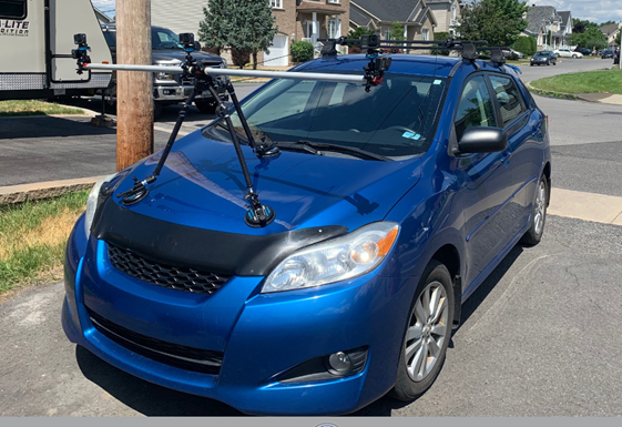
The first step is video- and photo-surveying using a vehicle with suction-cup mounted GoPro cameras. Next, thousands of photos are extracted from the videos to collect highly relevant and precise information about the landscape. Using machine learning, the system recognizes the content of the photos and maps them accordingly, thus accounting for all minute details and variables that may impact a project.
Additionally, the time it takes to capture photos and videos with this methodology is significantly reduced compared to other techniques (it can take anywhere from a few minutes to two hours versus a full day's work for a traditional survey).
A vehicle with suction-cup mounted GoPro cameras
Putting the tech to the test
Two pilot projects are underway to evaluate this capturing and modelling system thoroughly. These undertakings follow several small-scale trials launched in 2019 and 2020 to great success.
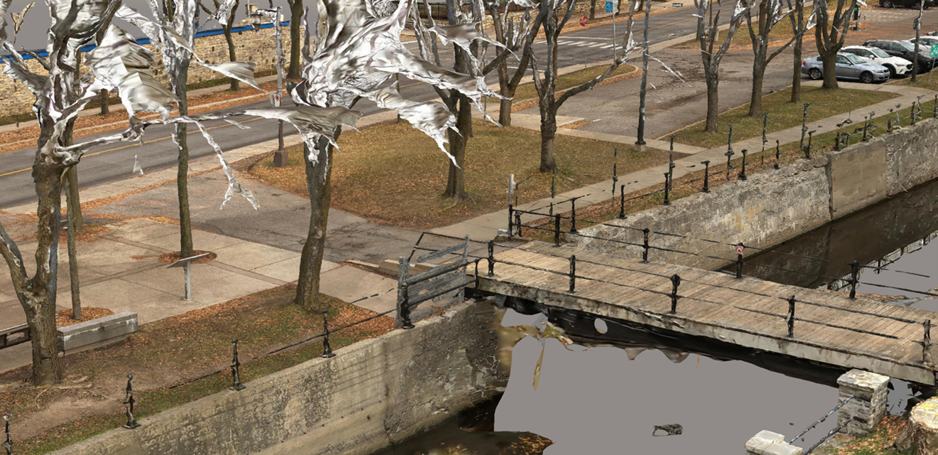
The first of these projects involves repairing the walls of the Lachine Canal and the second is the repair of the Maurice-Duplessis culvert, both located in Montreal. To ensure success, we're collaborating with veteran designers for crucial feedback and coordinating with expert surveyors to promote knowledge sharing.
Structural engineer Patrick Chartray highlights the technology's strengths, "The advantages are many. The model is to scale, georeferenced, and—above all—captures every relevant element: pavement, curbs, embankments… but also vegetation, signage, fences, road markings, traffic lights, lampposts, overhead cables, etc. Surface textures even allow us to easily identify different types of materials (concrete, asphalt, stone, grass, etc.). The solution is robust, as it lets us perform all kinds of checks and validations during the design or project execution stages."
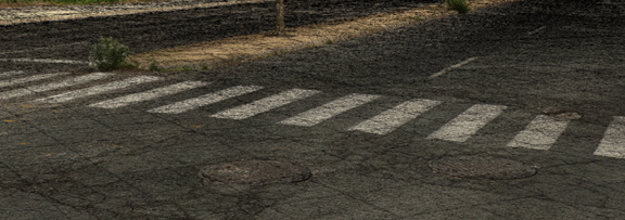
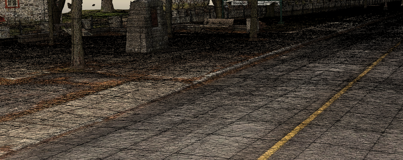
The level of detail we're capturing is, indeed, impressive. For instance, imperfections on pavement or concrete surfaces appear with exceptional precision. Just check out these images:
Images taken from the model created for the Maurice-Duplessis culvert repair project between the A25 and rue Marie-Victorin.
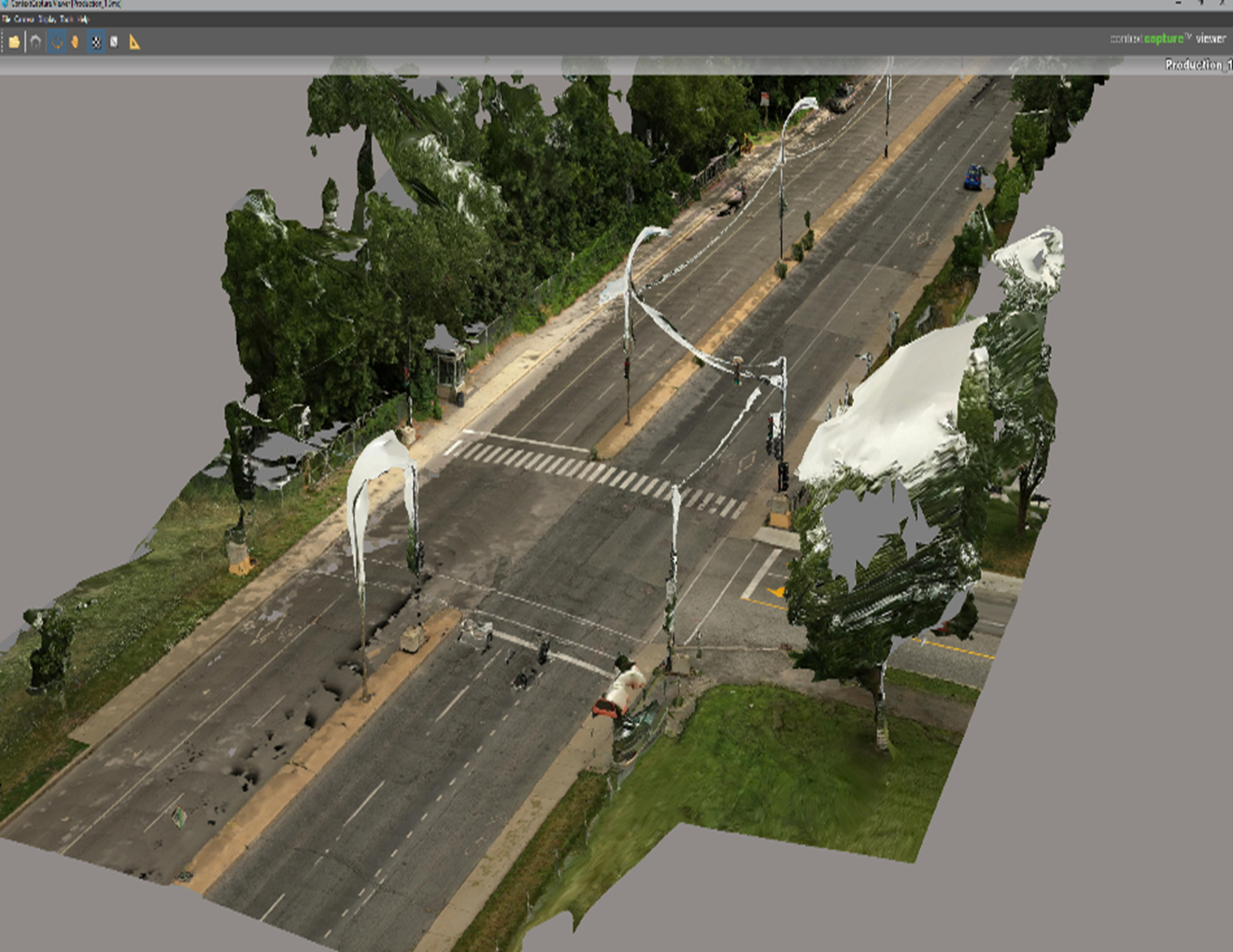
Images extracted from the model created for the Lachine Canal wall repair project.
Part of a 360-degree solution
Patrick further elaborates on the tech, "When leveraged for the right project, this tool does a lot—it's far better than other photo surveys available. Often with other surveys, we have to send our teams back onsite because we didn't capture pictures from a specific viewpoint or showing an important detail… This new type of survey largely eliminates these problems."
As Patrick notes, by receiving such detailed results—and thus maximizing the information gathered from a future work site—we're optimizing the team's time. Unquestionably, this time-saving approach can translate to reduced budgets.
Before, engineers would be responsible for assessing a project with only thirty or so photos. Now, these photogrammetry solutions provide thousands of reference images that can curb costly surprises during the project execution stage.
Of course, while certainly powerful, these models also sometimes work best when used alongside other technologies. Patrick notes, "In the Lachine Canal pilot project model, the precision is approximately ±100 to 180mm. Therefore, we cannot rely on these models alone for the entire design. Nevertheless, it really is a technology we can count on and one we'll certainly be incorporating in future projects."
What's next?
Big things are coming, and we're revving up for even more pilot projects. We're coordinating progress with engineering experts and communicating the solution and its potential to our business units.
Certainly, this technology isn't necessary for every client, so much of our work now is identifying the types of projects that will benefit best from this model and adapting the technology to different undertakings. As with any of our other services, there's no one-size-fits-all approach.
So, stay tuned—we’ll be sharing more insights as they unfold!