Cutting Edge
CIMA+ did its homework before launching its LiDAR drone field survey service. This was accomplished through several pilot projects carried out over the last two years. Two main reasons prompted the company to innovate: significant improvements in drone performance and the miniaturization of capture equipment. “Because of its size and design, the LiDAR technology used to be deployed by helicopter or aircraft, which obviously meant high operating costs. Not only that, but using an airlifted LiDAR to map a small area didn’t yield very good results,” remembers Julie Bétit.
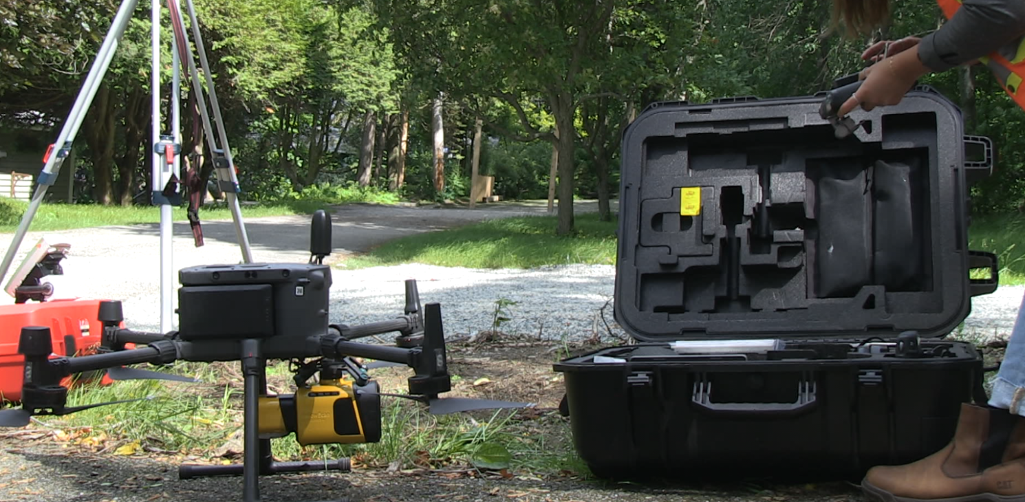
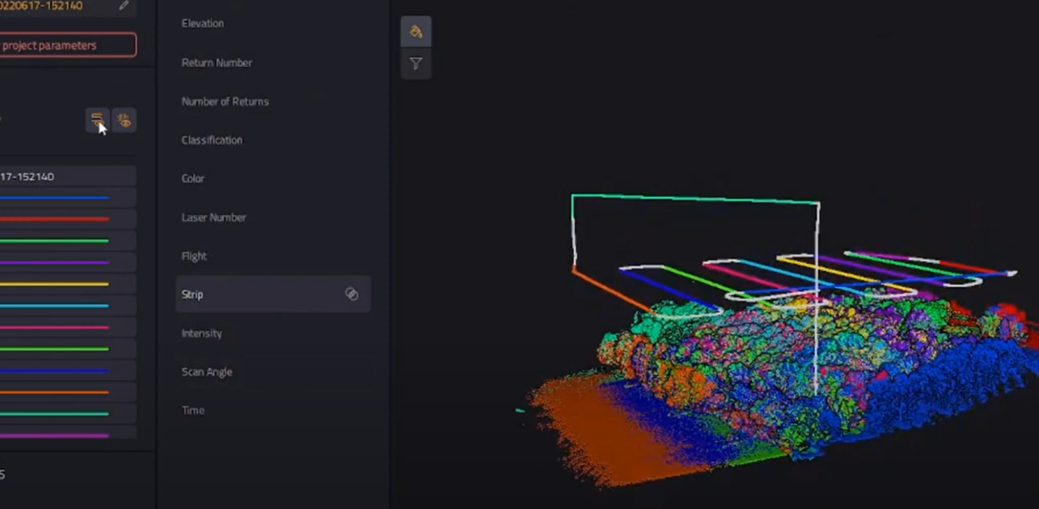
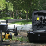
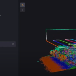
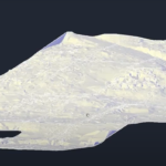
This is no longer the case. CIMA+ decided to rely on the YellowScan LiDAR Mapper+ which captures 240 points per square metre and colourizes them in a single flight. Weighing a mere 1.1 kg and highly accurate—between 2.5 to 3 cm—, its scanner includes three laser beams that easily penetrate obstacles, such as vegetation. It incorporates an inertial satellite navigation system that ensures its precise position, velocity, acceleration and orientation. To top it all off, Mapper+ can collect data up to 100 metres above the ground. “It’s the product that best satisfies our needs at the moment,” Guillaume Dubeau summarizes.
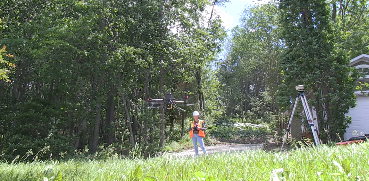
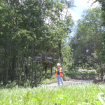
As for the craft onto which the LiDAR is mounted, it is DJI’s Matrice 300 RTK commercial drone. It can easily be compared to a modern small airplane: it offers up to 55 minutes of flight time, it is weatherproof and can operate in temperatures ranging from -20 °C to 50 °C. Above all, its numerous
redundancy systems ensure that every flight is safe. “It’s a very safe aircraft,” insists Guillaume Dubeau before adding that all CIMA+ pilots are licensed for advanced operations. Rounding out the picture, CIMA+ also has aviation insurance coverage for businesses.
A World of Possibilities
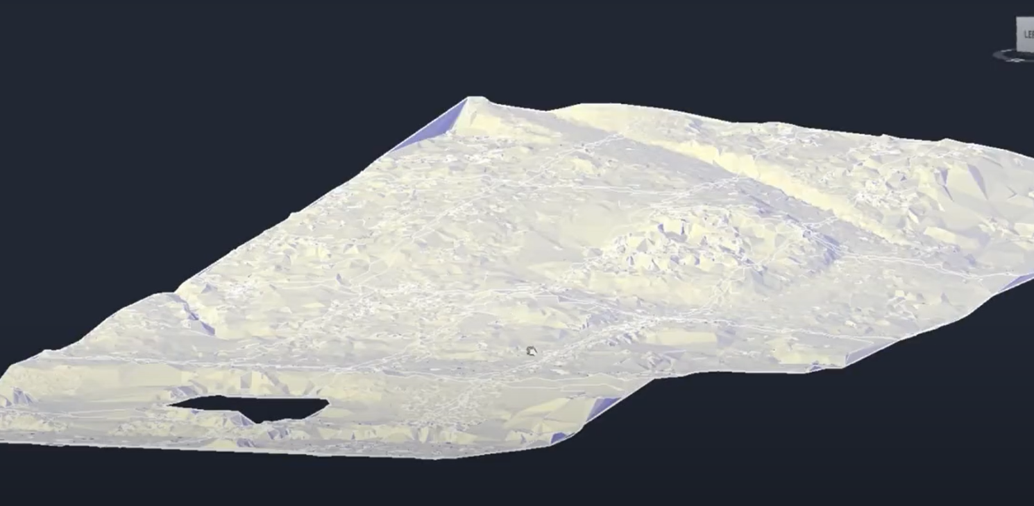
The advent of drone-based LiDAR field surveys will surely facilitate several endeavours. Last spring, in less than a day, CIMA+ mapped a popular Montréal bike path along vegetated shorelines. Thanks to this innovation, coastal erosion monitoring due to climate change will be easier to perform, as will field surveys along highways. “This technology could even be used for future residential neighbourhood projects developed on land covered with dense vegetation where it is difficult to chart the topographic curves,” concludes Julie Bétit.